

KEARNEY — Central Nebraska is in the calm between winter storm systems today.
Kearney saw the highest snow amounts in the Tri-Cities with Monday’s event, but the area needs to brace for more snow on Thursday and dangerous wind chills that will last into the next work week.
The Monday, Jan. 8 snowfall was driven by a large upper-level trough of low pressure that dug its way into the southern United States and was pulling up moisture from the south, feeding what would bring wet and heavy snow for the area.
The Tri-Cities and areas to the south and west were placed under Blizzard Warnings as the snowfall looked to be accompanied by winds that would gust over 30 mph out of the north-northwest.
Monday started out deceptively calm and even mild in temperature, but this was a result of easterly winds wrapping around the surface low pressure area and bringing up warmer, more humid air.
That would change as precipitation began to start moving south to north, a change over from a wintry mix to snow was seen in Kansas prior to the precipitation’s arrival in the local area.
Locally, the precipitation started as sleet in Kearney before changing over for good to snow. The snowfall rates varied on location, for instance Smith Center, Kan., reported three inches over four hours.
Area schools, anticipating the hazards, called off school on Monday.
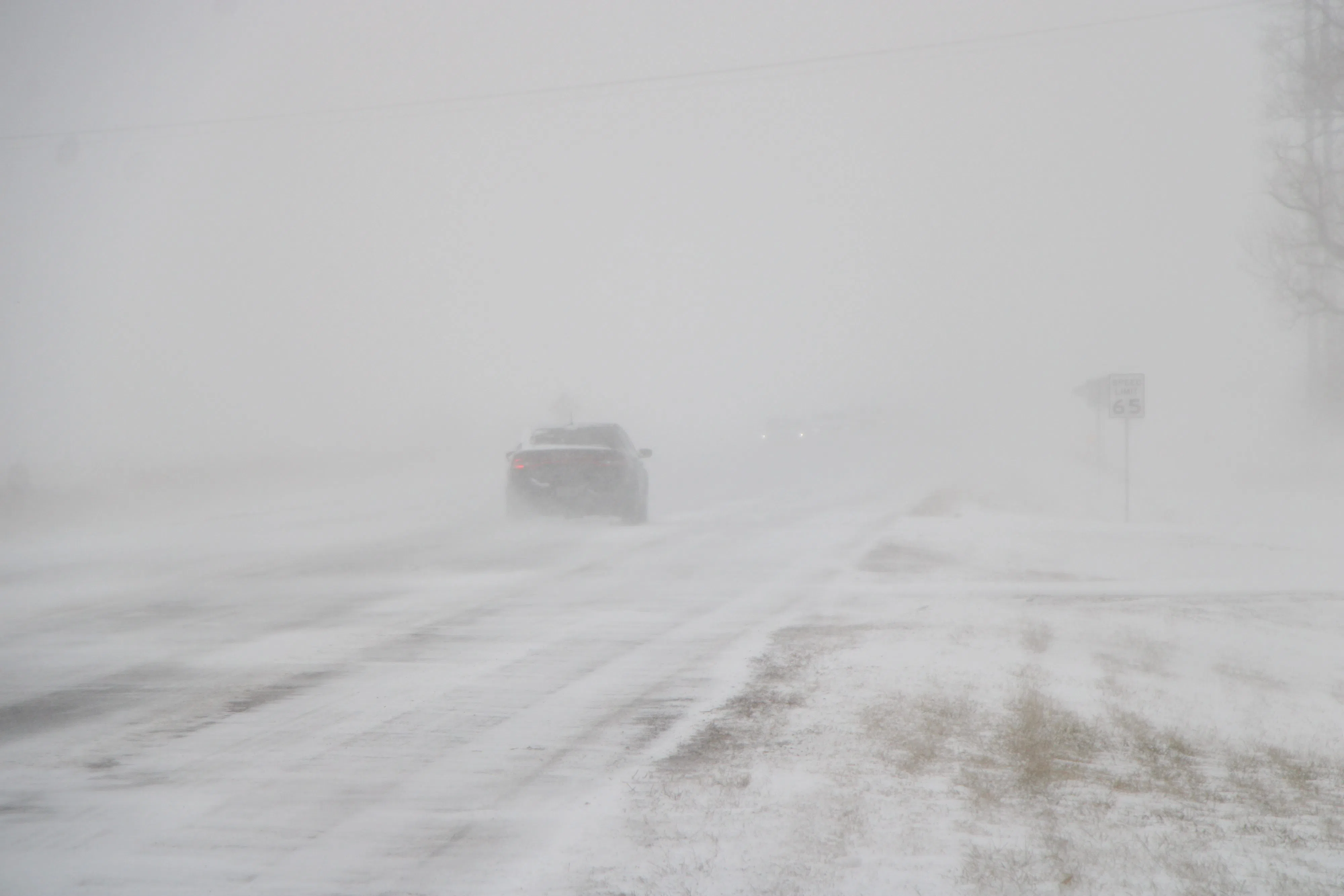
What would make the situation more hazardous was the winds. As the system progressed, winds started to shift out of the north and increased with gusts up to 30 mph. This led to blowing and drifting snow that would cause travel hazards throughout Monday afternoon and into the evening.
Eventually, white-out conditions would force the Nebraska Department of Transportation to close parts of Interstate 80 in central Nebraska. The closure would eventually reach from Grand Island to North Platte.
The Nebraska State Patrol reported that troopers performed 310 motorists assists, responded to 37 crashes and assisted other area agencies with 23 responses.
As Monday turned into Tuesday, residents woke up to a variety of snowfall totals, with the drifting snow exacerbating problems for certain areas.
The Adams County Emergency Management reported on Tuesday morning that several roads were nearly impassable and that several vehicles were stranded along the east-west running Highway 6.
Many area schools also called off school again on Tuesday to allow for the roads to be cleared more fully.
Areas that saw the highest snowfall totals were to the extreme east and south of the NWS Hastings coverage area.
A report two miles southwest of the village of Tobias in Saline County measured 11.5 inches. Shelby, in Polk County, also recorded the same amount.
Areas across north central Kansas saw reports from 9.3 inches at Plainville, Kan., to 9.0 inches in Lebanon, Kan.
Notably, Kearney saw some of the highest snow amounts in south central Nebraska with 8.5 inches measures. Sutton and Shelton both reported 8.0 inches.
Grand Island set two weather records for Jan. 8. First, Grand Island recorded 0.6 inches of total liquid precipitation Monday, which breaks the record of 0.35 inches of liquid precipitation set in 1937.
Grand Island also received 7.5 inches of snow on Jan. 8, breaking the record of 4 inches of snow in 1937. Precipitation and snowfall records for Grand Island date back to 1895.
To the south, the NWS Hastings office recorded 6.3 inches of snow.
Areas to the west of the Tri-Cities did not see as much snow, with Elwood reporting 4.0 inches.
The clean up from Monday’s snowstorm was ongoing throughout Tuesday and Wednesday, but the area will have to brace for yet more snowfall on Thursday, followed by bitterly cold wind chills over the weekend and into next week.
NWS Hastings noted that the Thursday storm system has been trending stronger, with 3-6 inches of snow possible and wind gusts out of the north at 25-35 mph. The timing of the heaviest snow appears to be from 6 p.m. on Thursday to 3 a.m. on Friday.
“Round Two starts in earnest late Thursday and brings more snow and frigid temps and wind chills. Please be prepared if you have to travel,” the Nebraska State Patrol stated.
Following on the tail-end of this system is bitterly cold Arctic air which will set the stage for wind chills that could reach -25 to -40 degrees. This will be similar, but shorter to the dangerous cold stretch in February 2021.
High temperatures will only be in the single digits at best Saturday through Monday.
Michelle Schuldt, meteorologist with NWS Hastings, said that Sunday morning will see the most severe wind chills, around -35 for most areas.
NWS Hastings notes that the 30-degree temperatures this week will be the mildest days the area will see for at least the next seven to ten upcoming days.
Monday will remain cold, but Tuesday appears to be the first day of some modest warming, with high temperatures reaching back into the teens.