

KEARNEY — Severe weather chances have re-entered the forecast as the area begins its transition to fall. Severe thunderstorms with large hail and damaging winds are possible from early evening into the overnight hours.
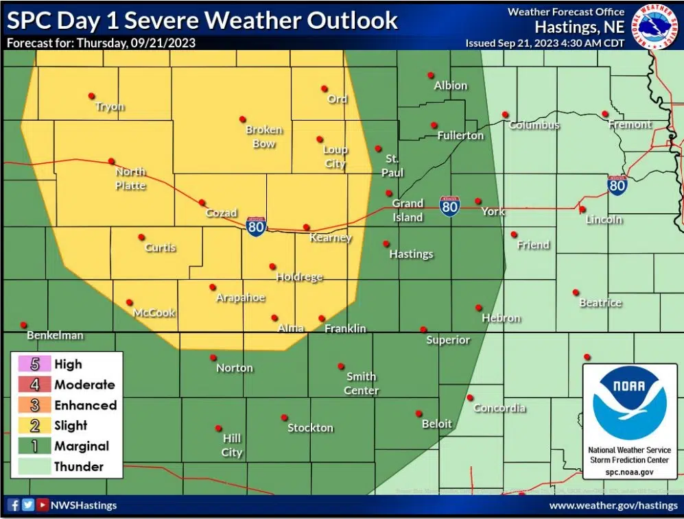
Much of central Nebraska is under a slight risk for severe weather, two out of five, according to the Storm Prediction Center (SPC), located in Norman, Okla.
A large upper-level trough of low pressure is present over the western part of the country and upper-level winds across south central and central Nebraska are mostly out of the west.
There will be sufficient instability and wind shear across the area to allow for showers and thunderstorms to develop and move across the area this afternoon into tonight.
The time of greatest threat across the area will be 5 p.m. to 2 a.m., according to the National Weather Service – Hastings. Large hail and damaging wind gusts appear to be the primary threats.
The chances for severe weather continue into Friday.
Over half of the NWS Hastings warning area is outlooked in a slight risk of severe weather for Friday from the SPC with the rest of the area in a marginal risk for severe weather.
Instability and wind shear values will be similar to Thursday. The greatest time of threat will be from 4 p.m. to midnight, large hail and high wind gusts again appear to be the primary threats.
Due to the cold front passage as a part of this system, High temperatures on Saturday are expected to be in the 70s and 80s, lows during the evening will drop into the 40s and 50s.
Upper ridging begins to develop over the Southern and Central Plains on Monday with a large upper-level low pressure system just off the northwest coast. Precipitation is generally not expected across the area on Monday.